
Winter is far from over in Portland, Oregon. Temperatures are predicted to stay below freezing in the metro area, well into the weekend.
On Wednesday, Portland International Airport recorded 10.8 inches, beating out the 9.3 inches that fell on a January day in 1956. This ranks as the second-highest amount of snow to accumulate over a 24-hour period, just behind the 14.4 inches in 1943.
Between Thursday night and Friday morning, over 650 people used emergency shelter beds and Portland officials are asking for volunteers to help staff some shelters until at least Saturday morning.
According to the National Weather Service, warnings of breezy conditions will occur for much of the day and could be dangerous if one is not prepared.
“Through Saturday night, we’re not going to get a lot of relief,” said Colby Neuman, a meteorologist with the National Weather Service in Portland. “We’ll get a little bit today and tomorrow during the days, but not much.”
Virtually every public and private school, community college and organization have announced closures due to the snowstorm that hit the region Wednesday.
Snow will stay on the ground Friday, which will keep temperatures in the mid-30s in the major cities located along the I-5 corridor.
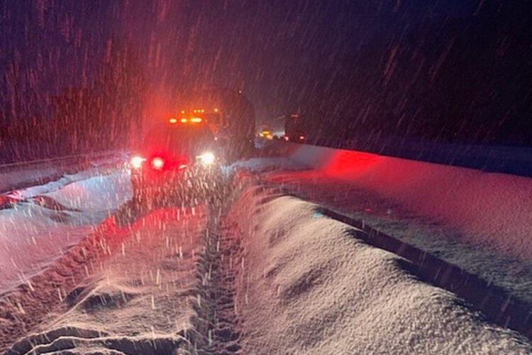
Tweet posted sharing an image of 84 west in Portland:
84 west still at a total standstill pic.twitter.com/htGUOrTZIX
— Ric Peavyhouse (@RPeavyhouse) February 23, 2023
Temperatures are predicted to rise to the low-40s by Sunday, although it is not expected to get dramatically warmer anytime soon.
Don’t expect a dramatic warm-up to more seasonal temperatures, Neuman said. The Portland area will struggle to get above 40 degrees on Monday and, on Monday and Tuesday, there’s another chance for snow.
Portland residents are encouraged to stay indoors and avoid the icy streets as much as possible until the ice and snow are able to thaw out some time in the coming week.


Add comment